Proactive Geohazard Risk Management

Meet Orkus, KIarian's platform to strengthen confidence in geohazard mitigation and management, ensuring the safety and reliability of pipeline operations even in the harshest landscapes.

Pipelines face constant geohazard risks, from landslides and tectonic activity to excavation and construction. If these hazards lead to stresses beyond the pipeline’s design, it increases the likelihood of leaks or explosions.
To ensure early detection and swift response, operators conduct extensive risk assessments, geohazard studies, and field reports. However, the sheer mix and volume of data can make geohazard assessment and management challenging.
Klarian is tackling this. We’ve developed Orkus, a service to provide comprehensive visibility and prioritisation of geohazard assessment and survey data. Orkus also processes data from operators' sensing technologies, enabling them to identify and respond to potential geohazards proactively.

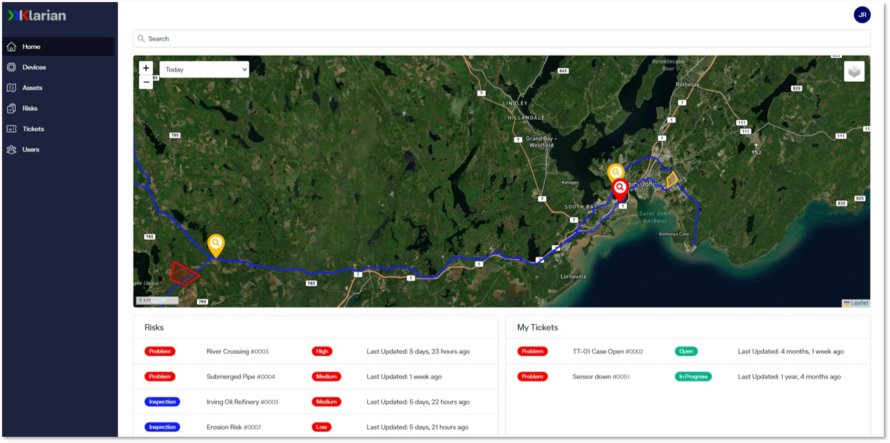
Orkus dashboard - Comprehensive geohazard risk management
Klarian's solution
Orkus offers a proactive pipeline geohazard assessment and management service to save costs and prevent reputational and environmental damage.
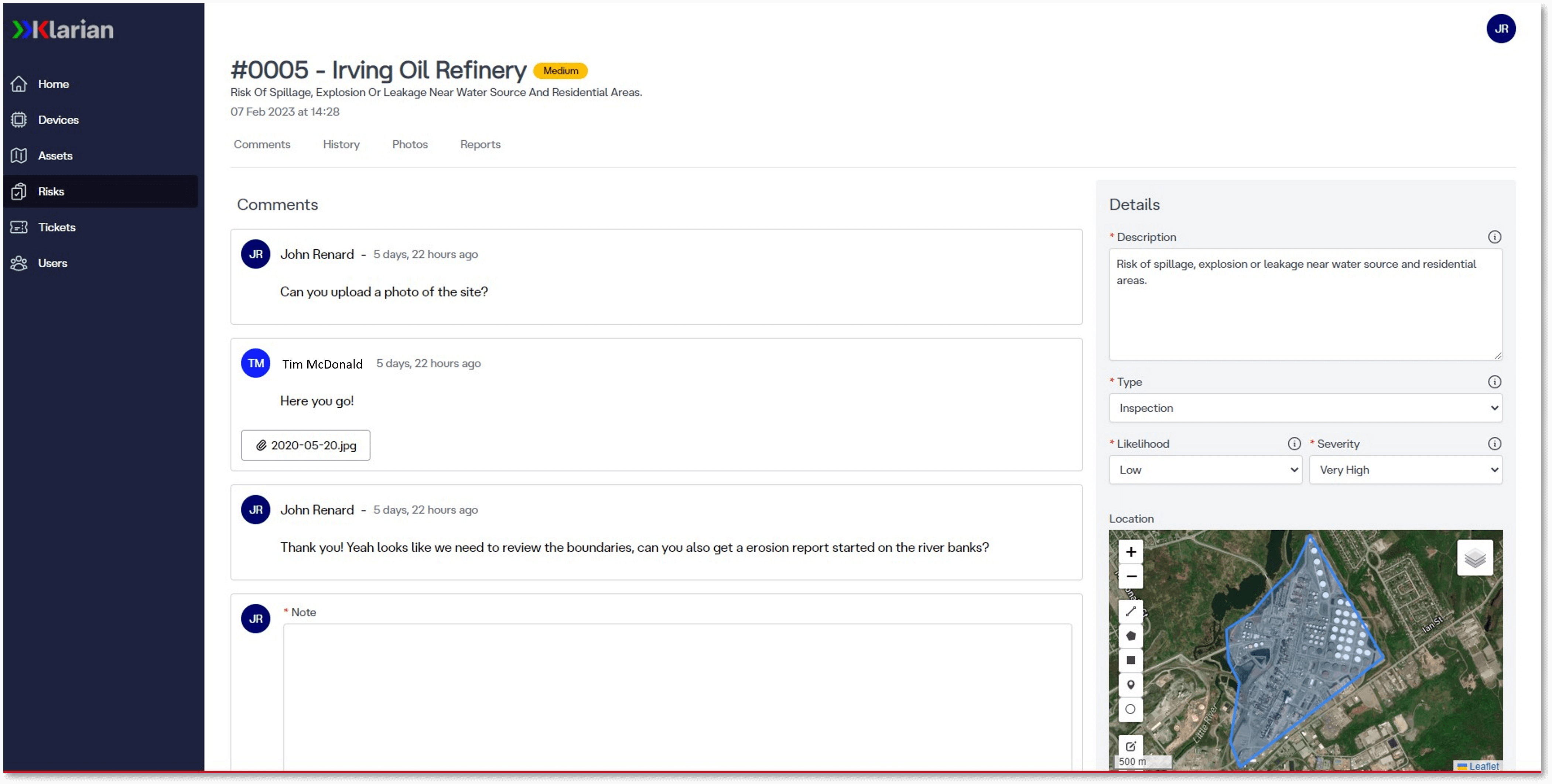
Managing outputs from mountains of risk assessments, geohazard studies, and field reports is challenging. No hazard is the same, so operators need a robust and consistent geohazard identification and assessment process to manage near and long-term risks with confidence.
Orkus has a geographic information system configuration. The platform offers a map view and time filter, displaying the locations of surveys, risk assessments, and relevant information like site photographs or live flood risk data.
With a clear visual of all hazards, our action tracker aids decision-making by providing granular prioritisation. Focus on genuine priority risks without getting overwhelmed by excess data.
Orkus' geohazard configuration includes an alert engine to track various geohazards, including landslides, floods, and other types of ground movement. Easily customise alerts via Orkus' user-friendly interface to match specific needs. On top of this, also access historical alert data for better decision-making.
Operators receive immediate alerts via email, SMS, and internal notifications on our platform enabling them to react swiftly to minimise potential hazards.

Orkus dashboard - detailed risk management.